Articles

Indian Mountains 2

Expand All

लिंग, जाती, ज़मीन, और सत्ता: चुनौतियों भरा सशक्ततकरण का एक सफ़र
Gender, Caste, Land & Power: A Journey of Challenge and Empowerment


Introduction

In India, soon to be the most populous country in the world and its largest democracy, owning a piece of the earth under the sun is akin to a primal urge for survival.

It is as much an idea filled with romance as it is a practical act of affirmation of one’s life – giving meaning to one’s existence, lending purpose to one’s will. It is also inextricably linked with a claim to power. Our history is nothing if not a repeated and continuous succession of dynasties and emperors staking claim to territories – it is a blood-thirsty drive to power, an ambition to own more and more.

It is also, hence, unequivocally, male. Land, and related shenanigans to it, especially owning it, controlling it, is stuff of the man’s world alone.

It is no wonder then that the structural systems placed around the possession and security of land have been in favour of men.

As we all know, it was with the amendments made in the inheritance laws in India as recent as 2005 that daughters were granted equal receipt of property, as sons. It was also lauded, and rightly so, as an overdue recognition of equal rights in the legal sphere.

But we also know that changing or revising laws on paper can mean very little in actual fact. And on the ground, where power norms and socio-economic codes are intermeshed like a tensile spiderweb, it is virtually impossible for women to take a stab at taking a claim to land.

According to an index created by the Centre for Land Governance, only 6.1% of all land holdings are held by women in Uttar Pradesh. The national average is 12.9%.

This is the context and the theme that this presentation focusses on. We are looking at land ownership in the context of rural women, who are doubly marginalized in their identities as Dalit.

What are the complexities of this scenario?
What are the challenges?
And most importantly, through the tales of a few brave women, we look at what it means when women speak up in the most male of spaces, on the most male of topics.
We take head-on, the question and conundrum of empowerment. Two of these brave women, Meera & Shyamkali, are amongst us today, and will now be presenting their personal narratives.
Meera will also present a third narrative, that of Gayatri.

The Many Lives of Land, from this lens, presented by Meera & Shyamkali

My name is Meera
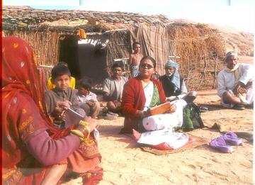
Meera

I have been a working woman for over 30 years my life – first in the area of social work, and then in the very exciting sphere of journalism, as a reporter and then an editor at Khabar Lahariya, India’s only feminist, grassroots news platform working out of the hinterland. I have been in Khabar Lahariya for over 18 years now.

I am an anomaly in the place I call home. This is because I am an educated, reputed Dalit social worker and journalist who is also a woman. But by accessing property rights – my entitled rights – I have been perhaps the biggest anomaly.

My brother and I were practically raised by my bua, my aunt who I have loved and doted on through my growing up years and beyond. As her sole caretaker, while also financially supporting my own family, I have been through hard times. But I supported my aunt because there was nobody else.

My bua has had no children of her own and the question of who would inherit the property she left behind, especially when she began battling with her health and started ageing, became a looming one, getting uglier by the day among my family – both immediate and extended.

As her sole caretaker, my aunt bequeathed it to me, but my struggles with claiming it as my own have been tremendous.

After years of processing and innumerable court rounds, I have finally got the land and the house officially transferred in my name. But the friction in the family has been immense. Everyone was of the opinion that a woman cannot be doing this – she cannot be going to the court so often, and she cannot be so hell-bent on having property in her name. I fought back tooth and nail. What is it about legalities that only men can understand? There is no such thing. I immersed myself in understanding the Indian legal system around inheritance – how it changes from centre to state, among other things.

I found the same discrepancies we find elsewhere. Such as in the much-feted Panchayati Raj system, where women’s participation is often showcased as respectable – indeed with a 33% reservation, how could it not be? But what happens in fact, on the ground?

All the authority that comes with being pradhan is the prerogative of the men in her life – her husband, her son, her father, her father-in-law. Women are simply told that they should take care of the children, the home, the family. But the concerns of the larger society, elections and politics? Leave that to us, the men say. What will you do running around trying to get it done?

Exactly what we are told in matter of land ownership too. Leave it to us.

But I leveraged my own stature and credibility in the local landscape, years of work that have got me to where I am today, to ensure that I do not leave anything to the men.

Today, the happiness I feel in having land in my name, a home in my name – mine and nobody else’s – is an unparalleled feeling, and one that I cannot put into words.

My name is Shyamkali

Shyamkali

I am a neo-literate Dalit woman, and have been a reporting in Khabar Lahariya for the last nine years. Working in the world considered for men and men alone – that is, the outdoors, which is everything beyond the four walls of a home – opened me up in ways I had never experienced before.

But, in Mahoba, where I live and work, being a reporter is not what a woman does. My new lifestyle was not acceptable in my milieu. My in-laws would harass me, plague me with their taunts and abuses whenever they got a chance. Why do you need to speak with men? Why do you come back home late? What is it that you’re really doing outdoors?

The verbal abuses turned physical, and there were days I would go to work, bruised and battered, often to report on cases of violence against women.

I chose to stay quiet for very long. I would come home and look at the faces of my sons and decide it wasn’t worth it to say anything, to retaliate or fight back. I would cling onto the hope that one day my husband will realize that this is wrong and take me away.

But things only got worse. I filed reports and complaints, we all did many rounds of police stations and courts, but we would always come back with compensatory frames of mind. I would be back in the hell-hole that was my home.

My patience broke one day and I left them. I took my sons with me and I went back to my parents' home. My husband and his family demanded that I return the children – that as sons, they were their future – but I refused. I gave birth to them, I said, so if it’s about possession, then they’re as good as being mine.

After a few years of living this way, I had new fears. Or perhaps they were old ones. Our socio-cultural norms say that girls are ‘paraya dhan’, and they have no right over their parents or their parents’ assets once they are married. What if my own mother and father abandoned me someday?

These fears urged me to take a big decision: To buy my own piece of land, for myself.

I am one of a handful of Dalit women, to have done this, I know. As a single woman, who is barely literate, I have also faced extreme backlash. A woman gives birth but she is stripped of all rights in this land – isn’t it time we took these rights back? Took this land back?

Today, my piece of earth sits bereft. I don’t really have the money to work on it properly, to think of building a home or anything. My parents keep telling me to do so, so that they can die in peace, they insist.

I often wonder if I should consider going back to my husband’s home, to take what’s mine rightfully. I am after all, the mother of his sons – I can claim my stake on that. All I have to do is don the mangal sutra and wear some sindoor again, isn’t it? That’s all that the society will ask for.

Is it right to feel this way?
Is it better to try and build on my own land?

How do I navigate these very grey areas?
These are the questions that haunt me every single day.

Listen to the story of Gayatri kisan

Gayatri

Unlike Shyamkali and Meera, Gayatri has never seen the insides of an education system, no matter how informal. She is a farmer who as is wont to the plight of a woman farmer in India, did not have the status or the official recognition of being one.

When she lost her husband approximately a decade ago, she found herself pushed to the wall by the patriarchal system that was determined to put her in her place immediately. Her husband’s male relatives, which included his uncle and nephew, propositioned her in a bid to gain rights over the land that belonged to her husband, and to control her sexuality. “It was the question of quite a few acres of land”, she told the Khabar Lahariya team when we interviewed her as part of MeToo Rural, an ongoing special series documenting stories of violence against women at the workplace in rural and small-town geographies, “And of course the question of my gender and caste (Gayatri belongs to the chamar caste) were always central to it – the intended violence and the violence.”

According to the NSSO Land and Livestock Holding Survey (2013), the share of land owned in rural India by different social groups was 13.06% for Scheduled Tribe, 9.23% for Scheduled Caste, 45.68% for Other Backward Class and 32.03% for others.

The average area of land owned per household was 0.650 hectares for Scheduled Tribe, 0.272 hectares for Scheduled Caste, 0.603 hectares for Other Backward Class and 0.816 hectares for others. But the 2011 SECC does not segregate ownership data by gender.

In our so-called agriculture-centric nation, the status and recognition of a farmer is limited to the men. In U.P. itself, 90% of women continue to execute all the heavy-lifting associated with farming – from ploughing, planting, harvesting, and storing the produce to transporting it to the markets and mandis for estimates and sales and selling – and yet both the financial gains and the status of the farmer is given to their male relatives. This is, simply put, because the land is not in her name.

This is the many-headed system that Gayatri chose to fight, indeed continues to battle even today. The threats of sexual violence, the repeated attempts to thwart her decisions around keeping the land, and registering it officially under her name, have been unending. “I worked for this, non-stop for five years,” she shared, “I appealed to everyone from the lehpal, the pradhan, the tehsildar, to the lawyer and the SDM and I did not give up. They would keep shooing me away, calling me chamar, calling me aurat, calling me illiterate, but I kept going back. The journeys to the administration, the tedium and circularity of the paperwork, I did them all.”


Meera & Shyamkali
Khabar Lahariya


References
- https://www.indiaspend.com/lakshadweep-meghalaya-have-most-women-land-holders-punjab-west-bengal-fewest-54024/
- http://mospi.nic.in/sites/default/files/publication_reports/Report_571_15dec15_ 2.pdf
- https://secc.gov.in/categorywiseHouseOwnershipStatusReport?reportType=Female%20Headed%20Category#
- https://www.youtube.com/watch?v=v9-vfMrhz6Q
- https://khabarlahariya.org/woman-farmer-double-hell/

Land into finance


India exemplifies what scholars have called a “global land grab” underway over the last decade. Millions of acres of land have been bought up for new highways, ports, townships, and industrial zones since liberalization, precipitating land conflicts that have embroiled more that 7 million people (https://www.landconflictwatch.org).

Contributing to this land grab are new ways of treating land.  It is no longer only a commodity that can be bought and sold; it has been transformed into shares that can be traded on stock exchanges or bought privately by investors: private equity firms, pension funds, sovereign wealth funds, hedge funds, insurance companies, etc.  While financialization does not entirely explain the complex reasons for an alarming uptick in land transitions and dispossession in India, it has played a role, increasing the amount of capital that can circulate through land and construction projects, contributing to demand for land, opening Indian land to speculative price increases, and tying local land politics to global capital flows.  

However, there are some characteristics of land that make transforming it into finance particularly tricky.  First, as Nikita Sud argues, land is multidimensional.  There are numerous and sometimes competing conceptions of what it is: a set of natural processes, a sacred agent, a productive resource, a source of pride, power, and livelihood (http://www.thisisplace.org/i/?id=6a5a2a34-f0e5-426c-927c-41f4376f3602).  Yet in order to transform land into an internationally legibile asset that can be traded as shares, it must be reduced (at least for some people for some time) to one dimension.  It must fixed, narrowed, and abstracted into strings of numbers that measure financial flows.  

Second, unlike other commodities that are standardized and easy to move (for example, money), land is geographically fixed, and parcels of it are unique.  To trade land requires a lot of work to transform it into documents or electronic representions that can be traded.  It must also be described in ways that make it seem standardized.  In order to make parcels of land into financial assets open mobile capital, then, one must do the work of “creating liquidity out of spatial fixity” (Gotham, 2009).

How do people flatten something multidimensional, standardize something unique, and move something fixed?  

When we take a close look at this process, it becomes clear that it involves a lot of people.  If we take the example of a publicly listed real estate fund, lawyers, accountants, and bankers help fund managers to go through the regulatory hurdles of listing a real estate fund on a stock market (the Alternate Investment Market of the London Stock Exchange was popular with Indian firms between 2006-2008). They also set up companies connected to the fund, which, through subsidiary companies, own parcels of land slated for real estate or infrastructure projects.  Those parcels of land are assembled from smaller parces by land agglomerators, brokers, and other intermediaries who work with individual landowners and local politicians.  Numerous consultants value those parcels of land and describe it as suitable for development.  Architects and planners map it and draw up plans for construction.  Bureaucrats provide land titles, ownership documentation, and land-use change approvals.  Real estate developers coordinate construction and advertise the finished buildings.  

Once the fund is linked through chains of companies to land and construction projects in India, investors from around the world can by shares in the fund and thus, indirectly, in the land.  These investors are often institutional investors, like pension or insurance funds, and thus their fund managers manage the investments of numerous smaller investors (individual pensioners, for example).  

Financializing land thus requires creating chains of intermediaries, from individual investors to local brokers.  Such chains connect people who each contribute something different to the process.  Intermediaries work together (though they each have different expertise and may have competing goals) to transform unique parcels of land into possible future asset streams – through agglomerating, titling, buying, and describing the land.  Creating chains of intermediaries by seeking out partners, consultants, buyers, and others, is a vital aspect of financializing land.  

We often use the metaphor of liquidity to describe finance.  Capital seems to flow around the world; it sloshes, it pools, it forms waves and tides.  But thinking this way makes finance seem like a self-propagating force.  When we look closely, we can see that financialization is not an an automatic or natural process but one that is inherently social.  Money doesn’t move on its own; people move it.  And to do so, they must create social networks.  Chains of intermediaries allow objects like Indian land to appear as possible investments; they thus enable financiersto accumulate capital through real estate and infrastructure development in India. As they do so, they contribute to the radical changes in land use, local dispossession, and economic degradation others have documented.    

For further reading, please see: https://www.tandfonline.com/doi/full/10.1080/03085147.2018.1538638
 

Llerena Guiu Searle
Assistant Professor, University of Rochester, Department of Anthropology
llerena.searle@rochester.edu
 

Adivasi land struggles in times of agrarian crisis


Since mid-2017, numerous farmers’ protests have been shaking India, exposing the rot below the country’s agrarian sector. Madhya Pradesh, where six protesting farmers were killed in police firing in Mandsaur in June 2017, and Rajasthan, where one of the first big farmers’ protests took place in Sikar in September 2017, saw change of governments by the end of 2018. These events show a clear sign that the agrarian crisis is going to be a major decisive factor in the upcoming general elections. 

The Forest Rights Act (FRA) received renewed attention in these protests. From 40,000 Adivasis who marched from Nashik to Mumbai in October 2018 to almost an equal number who marched in various rounds to New Delhi’s Sansad Marg, access to secure titles over forestland has been a loud demand of the protests. Other broad demands included loan waivers and higher minimum support prices. A special session of parliament was also called for to exclusively discuss the agrarian crisis. 

However, one constituency that has received less attention in these protests and debates is that of agricultural labourers, a large section of who are landless. A subset of these labourers belongs to the Scheduled Tribes and are doubly affected by non-availability of work in the farming sector and non-implementation of the FRA. 

Wayanad district in Kerala presents a microcosm of caste-stratified rural India and its agrarian crisis. Landless Adivasis, mostly belonging to the Adiya, Paniya and Kattunaika communities, have been struggling for land since at least the early 2000s, although the history of land alienation goes much further back in time. Four lessons emerge from my research in Wayanad on the impact of agrarian change on the lives and livelihoods of Adivasis, for the larger debate on agrarian crisis.  

First, land is considered not just a means of production, an asset for future or a symbol of cultural values and identity, but also a signifier of justice in a context of decades of structural violence. Drawing on Akhil Gupta (2012), I use the term structural violence to denote the injustice caused by formal and informal power structures that result in avoidable harm in the forms of poverty, malnutrition, physical violence and the like, resulting even in deaths. 

A “formal” means of structural violence can be found in the systematic dilution or non-implementation of laws meant to restore alienated lands back to Adivasis. The Kerala Scheduled Tribes (Restriction of Transfer of Lands and Restoration of Alienated Lands) Act 1975, which sought to restore all land alienated from Adivasis to upper-caste immigrants in the 1940s, was repealed under pressure from the latter, who were largely farmers then. A new law – the Kerala Restriction of Transfer by and Restoration of Lands to Scheduled Tribes Act – was passed in 1999 promising compensatory land to landless Adivasis, with much weaker provisions. 

Formal means can also work in the form of repeated constitution of expert committees to “study” a “problem”. Demands for declaring Scheduled Areas in the state have been sabotaged through the repeated constitution of committees to study how such areas can be identified in a state where Adivasis live interspersed with other communities. Declaring Scheduled Areas is expected to provide more autonomy to Adivasi grama sabhas as it would lead to the implementation of the Panchayat (Extension to Scheduled Areas) Act and provisions of the Fifth Schedule of the constitution. In parallel, Paniyas and Kattunaikas living inside forests in Wayanad are being displaced with a lean compensation of Rs.10 lakhs, including the cost of building a new house, in the name of building Tiger reserves. 

An “informal” means of structural violence can be seen in the blatant physical violence faced by landless Adivasis in the state. In Wayanad, the Adiyas and Paniyas have had a long history of being bonded agricultural labourers to feudal landlords, which means that they have faced stigma and exploitation under the caste system. Scarcity of work in paddy farms in Wayanad forced these labourers to migrate to ginger farms in Karnataka where former paddy farmers from Wayanad invested capital in large ginger farms. These farms turned out to be another site of physical exploitation for the labourers. Cultivable land is thus seen as a corrective measure, notwithstanding the larger economy of Kerala moving out of agriculture and falling state support for farming.  

Second, along with the high cost of cultivation, which is usually considered at the core of the crisis, there are other complex and less tangible changes underway on land that impact the lives and livelihoods of landless Adivasis. In Wayanad, the Paniyas are placed at the conjunction of multiple agrarian changes – scarcity of work in paddy farms, replacement by cheaper local labour in ginger farms in Karnataka, displacement from forests closed for tourism and conservation, and, in at least one town, the termination of work under the National Rural Employment Guarantee Scheme as the town graduated from a panchayat to a municipality. It is important to consider these multi-faceted changes that land is undergoing in the contexts in which Adivasis live, since exclusion too tends to be multidirectional in such contexts. 

Third, intergenerational aspects of land struggles deserve more attention. On following Adivasi households that had newly received land, it was found the younger generation, born into the agrarian crisis, are seeking other avenues of social mobility, especially through public employment. There needs to be an honest discussion about the future of farming and dependence on forest products from an intergenerational perspective, especially in light of scarce opportunities for self-entrepreneurship and skill development in the agrarian sector. 

Fourth, there is a difference between land distribution and land redistribution. Fieldwork in the Aralam resettlement site in Kannur district, Kerala, showed that those who were given land have been unable to use it, forcing residents to return to “colonies” or ghettoes where they lived. Land distribution programmes expect Adivasis to magically form a relationship with the land provided and get out of poverty. Such measures do not provide the technical know-how required to invest in agriculture or full titles required to make an asset out of the land. More importantly, they do not challenge the power structures underlying Adivasis’ marginalisation. “Redistribution”, in this regard, should proceed with the explicit aim of transferring social power through land. 

Both the Congress and the CPI(M) have been implicated in not doing enough to address Adivasi landlessness in Kerala. During the fieldwork, the BJP was seen attempting to gain a foothold in Wayanad using the issue of Adivasi landlessness, notably by mobilising landless Adivasis through the SC-ST Morcha. However, the state unit of the party received a blow when C.K. Janu, the firebrand leader of the Adivasis, recently chose to terminate her alliance with the party, disappointed with what she saw as the party’s empty promises. 

Given the importance of the agrarian crisis in the forthcoming general elections, the Wayanad story shows there is a need to consider the particular forms of structural violence faced by different Adivasi communities and incorporate them in critiques of the establishment. The critiques also need to take into account caste hierarchies within the broad category of “farmers”. Last, but not the least, it is important to consider the multiple meanings that landless Adivasis attach to land in times of agrarian changes that place them at the intersection of multidirectional exclusions.  


Sudheesh R.C.
DPhil candidate at the Department of International Development, University of Oxford

Is land multi-dimensional or the inert grounds for politics and history?


Within the sweeps and currents of contemporary academic research, land has been intensely debated and discussed. More so  in the humanities and the social sciences, where innumerable  studies, monographs and essays have explored the  myriad relationships and implications   between land, politics and  power under  an equally prolific number of themes such as  scarcity,  resource management, geopolitics,  identity formation and  violence (to name a few).  The idea of land, however, in many such writings continue to remain firmly within  a conceptual  black box of sorts: either as  abstraction or as the inert ground  upon which the sound, fury, twists   and noisy dramas of political economy play out. Land, in such renderings, is passive and imperturbably based on the understanding that only humans act with consequence.  

On the other hand, if one were to complicate the notion of land as being ‘multi-dimensional’ ─ brimming with qualities, possessing  agential capacity, inherently unstable, recalcitrant, intractable  and something that has to be  made rather than is a  given ─ then other  narrative possibilities erupt: the urgency to  explore  how things could  be vested with  constraints, capacities  and potentials that were previously held to be  within  the  exclusive  domain of the  human.  

An instance of this shift  that considers land as ‘vibrant matter’ (a term aptly coined  by  the political theorist Jane Bennett  to describe  ‘vital materialities’ in  the non-human), is particularly pronounced in a slew of recent writings on the  environmental histories  of South Asia. 

Debjani Bhattacharyya’s masterful Empire and Ecology in the Bengal Delta (2018), notably, discusses how the city of Calcutta (today’s Kolkata, West Bengal, India) rests on a forced, convenient and necessary amnesia. Modern day Kolkata, which in current times is ferociously being further transformed and consolidated into landed concrete property by real estate desires, was once overwhelmingly aqueous terrain, rutted with patchworks of marshes and seasonally churned by crisscrossing silt leaden flows. Turning this once soaking fluid ecology into    sturdy ground, however, was more than a technical task for sustained engineering intervention. Instead, for Bhattacharyya, Calcutta  was  reconstituted as a thriving land market  through a mix of  colonial legal codes, political practices, seizures of local resources and by a remorseless culture for ‘drying the city’. Put differently, Empire and Ecology in the Bengal Delta, urges us to reconsider why and how urban space drew their origins not from the colonisation of land but by profound transformations in  the  latter’s watery pasts. Understanding urban flooding in contemporary Kolkata, hence, is not entirely explained  in the many  trying  technical efforts to keep real estate dry but related from strongly  to the politics of forgetting:  how land came to be made in Eastern India.   

While contemporary Kolkata’s  unforgiving  and debilitating floods can, thus, be understood as  a chronic condition of land-making, the colonial pursuit and obsession for the dry still needs to be unravelled. And here Rohan D’Souza’s Drowned and Dammed  (2006) may be instructive. The emergence of  the idea and demand for  flood control in colonial Eastern India, D’Souza argues can be traced  to   the enactment of the Permanent Settlement Act (PS) of 1793. Introduced by Lord Cornwallis (1786-93), then Governor-General and Commander-in-Chief of the East India Company territories, the PS, not only sets the context for the commodification of land,  but,  critically as well, announces  the legal imperative  to maintain a hard separation between soils and flows. That is, the permanent ownership of revenue paying land as an alienable commodity was only possible if it could be sustained as the stable opposite to the impermanence of flows. Marshes, swamps, estuaries, wetlands or any admixtures of mud and liquids that made  land and water  indistinct could thus undermine the colonial economic order that  intimately rested on how the bourgeois ownership of revenue paying lands was tied to  the toil of peasant  production, agrarian surpluses and harnessing rivers through control. 

For  Dilip Da Cunha, however, in his  compellingly  argued and beautifully illustrated The Invention of Rivers (2019), the wet and the dry  have to be grasped as ephemeral moments within a broader   hydrologic cycle.  Consequently, India, for Da Cunha, ‘is a rain driven wetness rather than a land drained by rivers’. The soaking rains, in other words, sets in motion a series of complex and chaotic  interactions between the earth’s soils and the vast  oceans. Once acknowledged thus through ‘flow thinking’,   lands and rivers are revealed not merely as being tentative and ephemeral domains  but also urge for the careful  teasing out  of the   politics and cultures that drive  separations between the wet and the dry .          

If as environmental historians argue that land is not a contained stable hard surface and instead produced and repeatedly altered  by a range of dynamic geomorphologic and hydraulic processes, then ecological qualities and potentials do inform how power is assembled and shaped. A claim that, in fact, is compelling argued by Neeladri Bhattacharya in his magisterial The Great Agrarian Conquest  (2018), where he challenges the assumption  that South Asia before the arrival of British colonialism was overwhelmingly a peasant dominated  agrarian society. In  contrast, Bhattacharya convincingly demonstrates the opposite. That British India became an agrarian society by the systematic elimination and marginalization of pastoral communities, nomadism, slash and burn agriculture, forest dwellers, itinerant cultivators and hunter gatherers. In other words, the sprawling South Asian sub-continent was peopled by a vast collection of  livelihood strategies that harnessed a diverse   range of  environmental niches. Land as a mono-cropped factor of production for a peasant based and landlord dominated agrarian order in India, therefore, for Bhattacharya, is an all too  recent (nineteenth century)  phenomenon. 

Land as a multi-dimensional phenomena can, thus,  be  more compellingly acknowledged as something that is made by politics, power and ecology rather than simply a given that lies outside of history.   


Rohan D’Souza 
Graduate School of Asian and African Area Studies, Kyoto University


Frontier spaces: territorialization and resource control


Introduction

The global expansion of markets produces frontiers of contestation over the definition and control of resources. In a frontier context, new patterns of resource exploration, extraction, and commodification create new territories. A recently published collection (Rasmussen and Lund 2018) explores this emergence of frontier spaces as transitional, liminal, spaces in which existing regimes of resource control are suspended, making way for new ones. We argue that the new territorializations of resource control in a frontier space represent a set of processes that precede legitimacy and authority, fundamentally challenging and replacing existing patterns of spatial control, authority and institutional orders. 

Frontier Spaces

The notion of frontiers is increasingly relevant: the commodification of nature, the scramble for land and resources, the imaginaries of self and others, the erasure of existing orders, and the establishment of new patterns of governance and regimes of regulation. While frontiers used to be seen as linear movements across space, we see them as the discovery or invention of new resources. This reconfigures the relationship between natural resources and institutional orders. Rather than a ‘tidal wave’, frontiers mushroom across the globe. A frontier is not space itself. It is something that happens in and to space. Frontiers take place. Literally.

Frontier dynamics are intimately linked to their seeming opposite: territorialization. They dissolve existing social orders – property systems, political jurisdictions, rights, and social contracts – whereas territorialization is shorthand for all the dynamics that establish them and re-order space anew. Frontiers and territorialization seem to us to be co-constitutive. 

A frontier emerges when a new resource is identified, defined, and becomes subject to extraction and commodification. The ‘discovery’ of new resources – oil, gold, new crops like soy or oil palm, carbon storage, or ‘scenery’ – opens frontiers and challenges established rights. New resource frontiers emerge in different places around the globe. They do not exist as a function of geography per se, but are brought about because new possibilities of resource extraction and use prompt new and competing claims to authority, legitimacy, and access. Frontiers are linked to processes of land control and are actively created through social and political struggles. Frontiers are the discursive, political, and physical operations that classify space and resources as ‘vacant’, ‘free’, ‘ungoverned’, ‘natural’, or ‘uninhabited’. This happens by expunging exiting systems of right and use, and often by the dislocation of previous users. Frontiers, thus, pave the way for acts of territorialization. 

Territorialization, in turn, is the creation of systems of resource control, – rights, authorities, jurisdictions, and their spatial representations. However, when new resources are discovered or come within reach, new acts of frontier-making are mobilized to undo established territorial orders. This sequence is, in principle, cyclical: frontier–territorialization–frontier–territorialization …

This constant process of formation and erosion of a social order of property rights, socio-legal identity, and political institutions constitute a dynamic where governing institutions build, maintain, or lose their authority, and people become, or disappear as, enfranchised rights subjects. This process transforms nature into resources and commodities. Collectively, the collection of articles pursues a double argument related to the frontier spaces. The articles look at resource frontiers as dynamics of spatial control that fundamentally challenge existing institutional arrangements in a non-linear fashion. As new types of resource commodification emerge, institutional orders are sometimes undermined or erased outright, and sometimes ‘taken apart’ and then reinterpreted, reinvented, and recycled. In resource frontiers, the ideas of what constitutes the nature of resources, as well as the rules that govern their use and control, are reworked. We direct the attention to the vernacular political forms that constitute emergent institutions and struggles over legitimate rule.

This double argument relates to the ways in which the mushrooming of frontier spaces transforms the nature of resources in fundamental ways. Frontier spaces are intimately connected to commodification through processes of dispossession involving enclosures, land grabbing, and other forms of primitive accumulation. New technologies such as genetic modification of seeds in soy production or chemical procedures for extracting minerals ensure that particular geographical spaces can host recurrent frontier moments of capitalist extraction. Yet, despite mutating forms of dispossession, the replacement of systems of knowledge, the undoing of the commons, the valorization of nature, and its formalization into the uniform, legible commodification of resources seem to be ubiquitous.

Conclusion

Frontier dynamics and territorialization are intimately linked as destructive and constructive efforts at spatial resource control. Frontier and territorialization dynamics do not occur only in ‘remote’ regions. The dynamics that link space and resources are not a function of mere distance, but a particular configuration of values and institutions related to the commodification of nature. The discovery of new resources often takes place in populated places and leads political authorities like governments to disconnect people from place and to disenfranchise them. When frontier moments offer new opportunities of wealth capture, where institutional competition is intense, and where political power is skewed and livelihoods precarious, old established rights give way to the struggles for the reconstruction of new ones.

Policy Implications

These findings have a number of implications for policy-making. They include:
1.    The discovery and exploitation of new resources not only alter physical landscapes but fundamentally change institutional arrangements for resource control.  Development interventions in areas of resource extraction or conservation must therefore take into account the dynamic and shifting political terrain and acknowledge the multiple claims to resource control, and incorporate them into their designs. 
2.    New resources represent particular valuations of the environment. When drafting policies in areas of resource commodification it is therefore important to pay attention to the possible erasures of local values implied by the new extraction regimes in order to secure the continued inclusion of local populations’ needs, values, aspirations and development priorities. 
3.    Frontier zones are often violent spaces. Non-state actors and organizations, too, have territorializing capabilities. In contexts where authority is under radical negotiation, development interventions must carefully analyze these violent environments and the territorializing techniques that underpin them in seeking to enforce and authorize resource control. Consequently, policy makers should acknowledge their own potential role in the conflict. Failure to do so enhances the risk of inequitable and unjust development outcomes which support those actors who succeed to advance their claims and to territorialize them.    


Mattias Borg Rasmussen
Associate Professor, Department of Food and Resource Economics, University of Copenhagen

The pluralisation of the state in the megaprojects of India: the case of Dholera Smart City


As happens at every Vibrant Gujarat Summit (VGS), this year’s edition (VGS 2019) also saw a slew of MoUs with Chinese steelmaker Tsingshan Holding Group topping the chart with a proposed investment of $3 billion in Dholera announced by its founder Guangda Xiang in Gandhinagar (Ganguly, 2019). Considering 2017’s highly publicised MoU with Airbus France yielding nothing, this year’s MoUs could also be quickly forgotten. Such has been the fate of the proposed Dholera Smart City or Dholera Special Investment Region (SIR) since it was launched in 2009.

Over the last few years in India, Smart Cities have often been branded as an urban panacea. The Dholera Smart city, proposed in the western Indian province of Gujarat is the first prototype in India to be built entirely in greenfield, is the same silver bullet to cure India’s recurring problems of job generation, economic growth or urbanisation. Located in in the hinterlands, around 120 kilometers from Ahmedabad, the project is going to acquire a massive 920 square kilometers of agricultural lands across 22 villages directly affecting a population of more than 39,000. Simultaneously, Dholera is an important node in the Delhi Mumbai Industrial Corridor (DMIC), a $100 billion infrastructure project connecting the financial capital Mumbai with the administrative capital, New Delhi, by a 1,500 kilometers long dedicated freight corridor. Along this corridor, 24 industrial hubs, eight smart cities, two airports and many more infrastructure projects are to be built (PTI, 2016). Launched in 2006, DMIC was supposed to generate 25 million new jobs and increase the share of manufacturing in Gross Domestic Product (GDP) to 25% from a current 15% within 7 years (Kumar, 2015; Dubey, 2018).

Within these current discourses of development; Dholera has a unique history. It has managed to stay in the state’s visions of development since India’s independence from the British. The vast expanse in the Gulf of Khambhat has often been referred as banjar, saline and unsuitable for agriculture by the government. In the 1960s, when the Narmada Dam was being planned, Dholera was notified as one of the beneficiaries of the project. Naramada’s water is yet to arrive the farmlands of Dholera. Then in the 1980s, the government came up with an ambitious plan called the Kalpasar Dam, proposing a dam across the Gulf of Khambhat for establishing a huge fresh water reservoir for irrigation, drinking and industrial purposes other than using the dam as a 10-lane highway. 

While the project is still in the scheme of things of the government, nothing has been built on ground (TNN, 2011). In the 2000s, a Port was to be built in Dholera which would also have an industrial estate. The contract for the port was awarded to JK Cements which later collaborated with the Adanis to undertake the construction. While the port project was still on, an International Airport to ease the Ahmedabad airport was planned in Federa, 15 kilometers from Dholera. Then the idea was to build a Japanese city, where Japanese governments will invest was planned between Fedara and Dholera. In 2009, the Dholera Special Investment Region was proposed and the airport of Fedara was moved to within the Dholera SIR. Later Dholera SIR was incorporated into the DMIC and was also targeted to be developed as a Smart City.

However, what is interesting in this journey is how the idea of the state (read government here) or its institutions itself get pluralised in delivering such a project. As Dholera’s land prices skyrocketed with the announcement of the Smart City project, the vignettes from an ethnography undertaken at key sites of the project inform us about how the boundaries of the state and non-state gets blurred. In the villages of Dholera, government officials often moonlight for private land buyers and become key to land transactions. These officials even have private offices in the market places to offer real estate services. The patronage of the ruling political party or Hindutva organisations like Rashtriya Swayamsevak Sangh (RSS) is also key and these bureaucrats use their networks in these organisations to engineer a deal. People, active with RSS get easy and manipulative access to revenue offices, usually become middlemen and are key to any successful land transactions. On being asked why RSS is so important when one cannot even see an office of the organisation, one of these government officials responded with a smile: 

RSS does not need an office. Every temple is its office. Every Gram Panchayat can be their office. Every highway hotel can be their office. They just need their men to be leading these (places). If I tell you the truth, most of the people here in Gujarat have some association with RSS. See, even leaders in Congress have people with RSS origins. It’s just that they could not progress in BJP and hence moved to other parties. So, if I have RSS connections, even if it is Congress or BJP, I will be getting my business done. 

The local real estate dealers in Dholera mimics the formal institutions like VGS, bringing in bureaucrats, investors on the same platform to address issues faced by them. Interestingly, a senior bureaucrat at the nodal authority called Dholera SIR Development Authority (DSIRDA) has launched couple of real estate projects around Dholera in partnership with local businessmen drawing power from his position at DSIRDA. The working of the DSIRDA is no different. Despite being a government organisation, it is often represented by the private consultant it hired for the project, AECOM, with whom it shares the office physically in Gandhinagar. True to the revolving door phenomenon, planners working with DSIRDA goes on to join AECOM, after retirement or resignation. Conceptually, an analysis of these practices on the lands of Dholera, throws light on the multiplicity of the current government as it is entangled in the society.


Rakib Akhtar
DPhil Candidate in International Development, University of Oxford 

Land is the life line of the human civilization


In the universe the earth is the natural habitat of all the creatures including humans. The process of evolution of every species started with land and its axilary resources under its beneath and on above. When the human beings grew from one stage to the another stage of civilisation the land has been the primary source of food, shelter and sustainability with socio-economic-cultural identity. 

Land is not confined only to agriculture or residence or township. Land has been holding forest, mines and sea. In the present capitalist economic world there have conflicts of land verses industry, land as sustainable source of livelihood of farmers verses profits of corporates. There is conflict between forest and mining there is confrontation between small fisher men and vessel owners on the land of sea. There fore the conflicts mainly arise from the land as commodity for profit makers in the corporate world and land as sacred as the mother. The tribals treat forest a part of nature which is worshiped as God.

Specially the indigenous communities never accept land as commodity where as the global marketforce at present treat it as primary source of accumulation of capital through mining using unlimited water resources without any restriction. So every where the land is central issue and for vast majority of people, It is sacred. It provides primarily sustainability of food as primary source of livelihood of millions of people who have been marginalised in the process of development under the capitalist system, specially through globalisation, neo-liberalisation.

In India like many countries of Latin America and Africa the land, forest and water sources to the people of indigenous communities are very much dearer to the life and livelihood. Their socio- economic & cultural identities are with natural resources of which forest as land and its ecology is very significant. Therefore when the developmental projects are imposed on them for mining and industry they resist not to leave the land and struggle against corporates and the govt who uses police to repress them.

The intimate relationship between food security and land is universal. Where there is no land for growing food or forest as natural growth centre of food, there is either starvation or no freedom as colonised citizen to depend on other country for food supply. Though the per capita yield in land is increasing since 1960 by green revolution which destroyed the soil but the per capita an able land has decrease from 0.415 hectare in 1961 to 0.214 in 2007. The Earth is loosing 18.7 million acres of food sector per year. Near about 15 million acres only in developing countries for foreign investment. The global land project an international research network estimated 150 million of acres, whereas the land deal politics initiative in 2011 said 200 million acres were grabbed in the world. But Oxfam claims 500 million of acres in its report. Global tree cover of 73.4 million acres is lost till 2016 according research by University of Maryland, out of this 39 million acres in Indonesia. Each year fertile soil of 24 billion tons is being lost due to some erosion including Indian’s 5.33 billion. And the Earth has already lost 1/3 of fertile land in past 40 years. This is a state of crisis so far land’s future is concerned. It takes 500 years for 25cm of topsoil to be created amid unimpeded ecological changes. As per Indian space Research organisation (ISRO) 96 million hectares or 30% agricultural Land is already lost in India.

The state becomes undemocratic and despot being police-state to facilitate the interests of corporates. In the state of Odisha , Dongaria and Jharania tribals never agreed to greet Vedanta company neither for mining nor for industry. But the govt of unleashes state terrorism and forces the people to be displaced without prior consent and information. To exercise their right to natural resources the tribals of India from Odisha, Jharkhand, Chhatishgarh to everywhere resist to prevent such violent developmental models through which the land grabbing has become primary goal of capital investment by private companies. It is the need of time to prevent transfer and transformation of land to non- productive structure for food security in the world.

Niyamgiri hills as a sensitive ecological spot of the Eastern Ghat in India is the natural habitant of primitive tribals like Dangaria and Kutia tribes. She is also mother of two prominent rivers named Vasundhara and Nagabali which provide water resources to rich agricultural sectors of two states Odisha and Andhra Pradesh. It has dense forest where the tribal communities depend their source of livelihood and food security. They worship Niyamgiri as their God of law that is why they struggle against mining of bauxite which is the gift of nature for perennial streams and rive lets.

Since 2003 the people of Niyamgiri have been forced to be engaged to protest and fight against both the corporate hegemony of Vedanta company and the state repression. The Indian constitution in its 5th schedule, PESA ( Panchayat Extension to schedule area) and the forest Right Act (2006) empower the tribals to have their community rights over natural resources and the Gram Sabha ( Village council)  is the custodian and authority of such resources. This has been endorsed by the Supreme Court in its historical judgement in case of mining in Niyamgiri in 2013. The Judgement directed that the Gram Sabhas of scheduled area would decide to hand over forest land for mining of bauxite in Niyamgiri. Ultimatly 12 Gram Sabhas of 12 villages as referendum rejected mining proposal of Vedant Company. After decision of Gram Sabhas of Niyamgiri People the Govt of India had to ban mining in Niyamgiri. This is a victory of the people’s movement against corporate loot of resources like land, forest and water.

 
Such land movements anywhere in the world are preventive to the global climate change. As the national Governments are not prepared to have sustainable development without destroying the non-renewable resources like land, mines. The democratic struggles to protect land by the indigenous communities create rays hope to check the administration and force the governments to change their policies from destructive development to sustainable development with ecological justice.

How to protect Land by united global campaign

We have to make a consensus on 
•    Let us have global campaign against corporate capture and global capitalism.
•    United fight for right to land with in each nation and also strategic campaign globally. We have to struggle for a strong law for mandatory prior information and pre consent before land is diverted or transferred.
•    The  land having cultivation of food crops including Natural Forest of having habitat right of indigenous people can not be used for  non-agriculture and can not be  treated as commodity to convert to commercial goods and services.
•    Land should not be personal property or state property; it should be commons under communities.
•    There should be land reforms by which land can be distributed to small farmers for mass production 
•    There should be no primitive accumulation of capital through land. Where ever it happens, profit must be shared by the farmers as the original tenants of land.
•    Land can not be considered as community ownership of only present generation but the futures generations are also inheritors for inter generational equity.
•    In every country we have to strive for a national policy how to use natural resources economically with ecologically soundness and have a line of control on present developmental process to protect and preserve the non renewable resources for future generations.    


Prafulla Samantara
Goldman Environmental Prize Winner (2017), Asia
National Alliance of Peoples Movements (NAPM), India


Land is life for adivasis


“Jan Denge, Jameen Nahi Denge” (We shall surrender our lives but not land). This has been the most popular slogan of the Adivasis’ Movements against Displacement (AMD) across India for last couple of decades, which clearly indicates about the meaning and importance of land for them. ‘Adivasi’ literally means the aboriginal or original inhabitant or first settler of the land.  Undoubtedly, the Adivasis are the indigenous peoples of India, which is legitimatized by the Supreme Court of India through its judgement (SLP (Cr) No.10367 of 2010 Kailas & others Vs State of Maharashtra), stating that the tribal people (Scheduled Tribes or Adivasis) are the descendants of the original inhabitants of India . However, the Indian government denies their Indigenous Identity and recognizes them merely as the scheduled tribes through the Indian Constitution and laws even today. 

There are 744 Adivasi or indigenous ethnic groups in India but only 645 of them are identified as the Scheduled Tribes. As per the Census 2011, the Adivasis are 8 percent of the total population with 104 million people, treated as the most marginalized and vulnerable communities in India. An Adivasi legend Dr. Ramdayal Munda describes the true characters of the Adivasi community as ‘casteless, classless, based on equality, community based economic system, co-existence with the nature, consent based self-rule, dignity and autonomy . The Adivasis live in or around the nature. The government’s data suggests that 89.9 percent of them still live in the rural areas, and merely 10.1 percent  of them have shifted to urban centers. The Adivasi economy, which is also known as the community or need based economy fully depends on forest and agriculture. 

The natural resources are the most essential sources of livelihood for the Adivasis but the land is most important among them. However, they do not perceive the land merely as a livelihood resource but they consider it as their heritage, history, autonomy, identity, culture, existence and life. They believe that their sole existence relies on the land. Therefore, if the land is lost, their existence is gone, which could be seen in the cities like Jamshedpur, Bokaro and Ranchi. The so-called civilized people treat the land merely as property or commodity, and sell it in the market rate to make money as much as possible, but the land is life for the Adivasis. That’s the reason why they have been struggling to protect their land for the centuries.  

In the ancient period, the Adivasis possessed undisputed ownership rights over the natural resources and they judiciously used these resources to fulfil their needs . They enjoyed autonomy, peace and prosperity with the nature. The situation rapidly changed with the Aryan invasion and turned worse during the British rule in India. On the one hand, the Aryans destroyed the Adivasi civilization, denied them their indigenous identity and did not accept them as fellow human beings, and the Britishers, on the other hand, used violence against the innocent Adivasis for grabbing their land, territory and resources, declared them uncivilized and even listed 127 Adivasi ethnic communities as criminal tribes .

The British introduced a centrally organized administration, a judiciary and a police system. They also introduced the concept of private property as opposed to the traditional notion of collective usufructuary rights of the community. Thus, the natural resources of the community were coined as ‘property’ and individual owners were created. The communal resources were considered as the ‘eminent’ domain and taken over. The forests and other individually unclaimed fallow lands were declared as the property of the State.

Gradually, the government enacted various policies and laws, which induced the marginalization of the Adivasis. They were deprived from the natural resources merely for the government’s revenue yielding measures. The Adivasi way of life was destroyed by imposing revenue on land and duties on the forest produces. The Land Acquisition Act 1894 was the last nail on the coffin, which resulted a huge deprivation of the Adivasis from their land, territory and resources. 

After India’s independence, the land alienation was on the rampant. There have been three types of major land alienation of Adivasis – legal, illegal and forcefully. The India State used the Land Acquisition Act 1894 for so-called legal land acquisition and ‘eminent domain’ for forceful acquisition of the Adivasis’ land under the tag of ‘public interest’, ‘national interest’ and ‘development’. The estimated data suggests that 28.2 million Adivasis have already been alienated, uprooted and displaced from their land, territory and resources in the name of public interest, national interest and economic growth & development since 1947 to 2004. Despite the prohibition of the Adivasis’ land alienation legally, the Annual report of the Ministry of Rural Development (Government of India) unfolds that 60,464 cases regarding 85,777.22 acres of illegal transfer of Adivasis’ lands were registered till 2001-2002 . Furthermore, 2,608 cases of illegal land transfer were registered in 2003-2004, 2,657 cases in 2004-2005, 3,230 cases in 2005-2006, 3789 cases in 2006-2007 and 5382 cases in 2007-2008, which clearly indicates that the cases of illegal land alienation are increasing rapidly. The Adivasis’ alienation from their land, territory and resources, has resulted in their impoverishment, destruction and extinction. They have lost their identity, autonomy, language, culture and tradition.      

However, today, the Adivasis have been facing even more threat of being alienated, uprooted and displaced from their land, territory and resources. The present nexus among the State, the Corporate Houses and the political parties, seems to be busy in amending the safeguarding laws made for Adivasis, suppressing the dissent voices and crushing down the democratic Adivasis Movements through police and military operations. For instance, the state government of Jharkhand amended the Land Acquisition, Rehabilitation & Resettlement Act 2013, attempted to amend the CNT Act 1908 and SPT Act 1949 and constituted Land Bank, where 2.1 million acres of community land, which includes the commons, sacred grooves and forest land, enlisted. Besides, the government has also brought the Industrial and investment promotion policy 2016 to create an industrial corridor in the state. Therefore, there is a thrust need to understand, respect and acknowledge the Adivasi’s perspective about land. Pressurize the Central and state governments for the enforcement of the safeguarding laws, constitutional provisions and Supreme Court’s judgements regarding the Adivasis rights. And fight for the protection of the Adivasis’ land, territory and resources.  


Gladson Dungdung
Adivasi activist, author and researcher 
gladsonhractivist@gmail.com  

Titling and commodification of land in India


This paper seeks to address India’s quest for a guaranteed title to land  in the context of commodification of land. The neoliberal paradigm of development advocates secure property right in land as the basis of market oriented economic development and growth. In the land titling regime, the state would provide guaranteed title to land to the property holders by making it legible, clear and easily transferable as commodity and indemnify it through title insurance. It   has emerged as an alternative policy option to the redistributive land reform agenda of the Indian state thanks to economic liberalisation. The launch of the world’s largest land records digitisation drive under National Land Records Modernisation Programme (NLRMP/DILRMP) is the driving force behind the “reform by stealth” approach to land titling. 

The paper seeks to interrogate how the neoliberal policy of secure individual property rights in land in the form of guaranteed title to land would address the land questions in India. In the process, I explore the World Bank’s advocacy for pro-market land policy for growth and poverty reduction and Hernando De Soto’s advocacy for formalisation of property rights in land as the dominant neoliberal approach in the context of India’s land questions. Does the need for land titling emerge from the political pressure from below or policy pressure from above or outside? Does the emerging political economy of land and development in rural and urban India or emerging land questions necessitates land titling initiative by the Indian state? How the capitalist or market imperatives of efficiency and growth in land policy can bypass social concerns and compulsions surrounding the land questions in India?  The paper focuses on some interrelated questions concerning India’s reform by stealth approach to land titling.

First, I examine the policy orientation of the Indian state from land reform to securing guaranteed title to land through modernisation and integration of land records management is explained.  Second, I discuss the contemporary neoliberal discourse of secure and individual property rights in land critically (especially of the World Bank, Hernando de Sotto etc.,) and how it perceives land rights and land tenure system in terms of efficiency, marketability and economy rather  than social equity and justice. Third, I examine the so-called second wave of land reform in the developing regions like Africa, Latin America and South East Asian countries aided and guided by multilateral donor agencies like the World Bank in the context of liberalisation, privatisation and globalisation . Fourth, I discuss evolution of property in land in India especially from the colonial period, continuities and changes of the land tenure systems and the continuance of the presumptive nature of land records and ownership created by the colonial authorities. Fifth, the emerging political economy in land and development such as urbanisation, land use trends and practices, emergent ruralities, naxal violence, commodification of land, changing land tenurial practice in the Scheduled areas, declining per-capita landholdings, conversion of agricultural land, vanishing CPRs, feminisation of agriculture and agri-land grabs for private capital are discussed in the context of India’s policy shift towards land titling regime and economic liberalisation. In chapter five, a critical examination of legal and institutional arrangements for the proposed land titling regime (draft urban and rural land titling bills) has been made with reference to the existing constitutional and legal arrangements of land, land records and land rights institutions. In chapter six, two contemporary dominant but seemingly contradictory land questions, revisiting the land reform through promoting rights based agenda like gender, tenancy rights and tribal and/or promoting land titling and land market policy options are critically analysed. The conclusion summarises the study and highlights  many theoretical and policy/political  implications of the study; how the India’s quest for  land titling has raised  critical issues of property rights in land, its implications on gender, tenants, tribals and other landless and homsteadless persons having livelihood interests on lands owned by others.
 

Dr. Pradeep Nayak, OAS
(Formerly Fellow, IIAS, Shimla)
Chief General Manager, Odisha State Disaster Management Authority (OSDMA)

The road to the forest goes through the forest dwellers


The word ‘Himachali’ almost invariably conjures up an image of the evergreen mountain herder (male or female) with a bamboo stick (and sometimes a flock of sheep), dressed in handwoven woollens, in the backdrop of forests and the snow-capped Himalayas. This depiction of the inhabitants of the region, though reduced to a ‘poster’ to attract tourists today, cannot be entirely dismissed as ‘romanticising’. The trilogy of farm-forests-livestock has been a bedrock of mountain economy, society and culture from time immemorial. Even now in the state of Himachal, 90% of which is rural, atleast 2/3rd of the population depends on land-based livelihoods. Since only 11% of the state’s geographical area is under agriculture, land here refers not to that which is owned privately alone but to everything from the river bed in the valleys to the alpine pastures in the high altitudes. Mule owners draw sand from the river bed, fisher people fish for trouts and mahaseers, women and men make long trips to the forest for fodder, fuelwood and leaflitter for the farm and animals, nomadic and semi-nomadic pastoralists still engage in a well-planned annual migration cycle to tap the seasonal abundance of pastures from the terai areas in the Shiwaliks to the trans-Himalayas. Modernity has shaken the system, but has not been as rapid in its unfolding, atleast in many of the mountain states.  

Colonial Ruptures

Contrary to common belief, it is the dependence on the ‘commons’, of this extent, that ensured the sustained use as well as preservation of the forests for thousands of years. The first significant rupture in this nature-human relationship in Himachal and parts of the Western Himalayas, occurred in the colonial period. Historical accounts reveal that up until then, it was the princely rulers who were owners of territories, but on the ground and in the villages, it was the clans and the deities known as devtas who were managing the forests. While there were several practices, within the hill societies, that may have been exploitative and needed reform, colonial interventions targeted commercial exploitation of forests for the Empire’s expansion. State control over forests was ascertained by putting in place a forest department and making it the custodian of forests. This was the beginning of distancing the forest dependent mountain communities from a living system that they considered themselves to be a part of. The Indian Forest Act was legislated in 1927 to ‘reserve’ forests under state control. The colonial mindset precipitated the view that, “proper demarcation of all land” and “scientific management of forests” was absolutely critical, and the idea that the hill peoples were “backward” in these systems.  It was the British, for instance, who introduced the propagation of the Chir Pine through monocultures, which eventually went on to be promoted by Himachal’s forest department right upto the 1980s. Today these plantations are mainly responsible for the widespread forest fires in Himachal as well as the severe fodder crisis. 

Control of forests by the Indian State

Post-independence, though brought land reforms in Himachal to grant land to the original tillers and abolish feudal control over agricultural lands, as far as forest areas were concerned there was a continuation of the colonial legacy. The National Forest Policy 1952, enacted shortly after freedom, made this obvious. ‘Village Communities in the neighbourhood of a forest will naturally make greater use of its products for the satisfaction of their domestic and agricultural needs. Such use, however, should in no event be permitted at the cost of national interest’, it was stated. The guideline of at least 2/3rds of a hill state area being under forests was also spoken of and Himachal government instantly declared all land that was not under private ownership to be ‘protected forest’ through an official notification in the same year. In 1974, through a new law common lands with Panchayats, used for grazing and other livelihoods were taken over by the State government. While part of this land was set aside for allotments to landless people, over the rest of the land the forest department asserts its control. And this way close to 70% of the state’s geographical area came to be declared as ‘forest land’.

Conservation and Development

It was not the process of expansion of state control alone that challenged people’s ownership on forests. Himachal Government, infact carried out a ‘forest settlement’ exercise in the 1970s where by it recorded community’s customary user rights, though only as ‘privileges and concessions’ which could be taken away at the will of the state. Which is exactly what happened through the twin agendas of ‘development’ and ‘conservation’ – both working together to stop people from accessing the forest lands. Dam building projects like the Bhakra Nangal swallowed thousands of hectares of forests – a process that continues in today’s age of four lane highways, urbanisation and expansion of tourism. The ‘conservation’ narrative of ‘inviolate spaces’ – forest habitats with no human interference - was institutionalised through the Wildlife Protection Act 1972. Today there are 13 National Parks and Sanctuaries in Himachal where access to forests has been curbed, for communities like the pastoralists. The shrinking of space for communities to exercise their land-based livelihood options continued with the 1980 Forest Conservation Act which disallowed the diversion of any forest land without the permission of the central government. This meant that even those who may have been allotted land for cultivation from the ‘common pool’ in the 1970s, but had not received titles over the land remained illegal occupants in the record of rights. “Encroachers” has become the dubious label applied to all “illegal” occupants and users of forest lands, especially by the judiciary, even as the juggernaut of urbanisation and development legally usurped vast stretches of forests. In Himachal Pradesh since 1980 (after the FCA was passed) close to 12,000 hectares of forest lands have been ‘diverted’ officially, mostly for large projects. 

Securing the symbiosis

In many parts of the state today, like the tribal district of Kinnaur, or the Gujjar and Gaddi dominated Kangra and Chamba, struggles for assertion of rights over forest lands have become rife. The emerging ecological crises and the breakdown of customary occupations in absence of new opportunities, especially for the youth, are grounds for simmering discontent. The institutional and political mechanisms required today, given the ecological limits we have hit, have to be those that strengthen the human-nature symbiosis even if it is not the sort that once existed. Those who depend on land and live close to the forest need to be ensured of their tenurial rights for justice, and for them to be custodian of forests. Today, if there is a piece of legislation that helps land dependent communities exercise legal tenure for their bona fide needs, it is the Forest Rights Act 2006. Enacted by the Indian Parliament precisely to undo the ‘historical injustice’ meted out with indigenous and forest (land) dependent people, the FRA not only recognises the community and individual user rights but also puts the responsibility of ‘protecting’ the forest lands in the hands of the community. The act is considered radical also because it makes these rights ‘inalienable’, meaning that they cannot be taken away without consent of the ‘gram sabha’ or the general body of a village. However, a decade after passing of the law, Himachal remains its worst implementors. The State machinery is operating under pressures of twin paradoxical global agendas, of preserving forests as ‘carbon sinks’ and continuing extraction for economic growth (and its own self-interest). As a result governments have systematically delegitimised and diluted the application of this Act, which holds the promise of  decolonising both - the forest, the forest dependent people, in frontier regions like Himachal Pradesh.


Manshi Asher
Himdhara Environment Research and Action Collective

Igniting new development trajectories in coastal southern Kerala


If they are one of its most visible, the eroding and accreting beaches of the Thiruvananthapuram coast have drawn surprisingly little research. 

For the fishing communities, the shore is of primordial importance, and its uses are multiple. Occupationally, the fishermen dry or mend their nets on this shore. They also keep their boats and, weather permitting, they go fishing directly from there. Economically, the shore is where fish is sold at its freshest, with the hope of a better price in consequence. Socio-culturally, the shore is also a space of relaxation, where people sit together, chat, look at the sea, play cards or, for the youngest, football. It is furthermore a place where people sleep at night when it is too hot in their crowded huts or houses. Some believe it to have healing powers in terms of sleep quality and associated physical benefits, and others believe that the negative behaviour of their partner on the beach would directly harm their husband at sea. Ecologically, the shore absorbs the high energy from the waves and represents the best protection against adverse climatic events, so that recent expert opinions ask to leave the beach to the sea as its playground (cf. Kurien 2018 ). Whether one considers it to be part of the sea or of the land, the integration of all these dimensions makes it clear that the shore is an integral part of the nexus between sea and community, whose value can only be fully grasped in relational terms. 

What happens, then, when the complex and seasonal dynamics of beach erosion and formation get disrupted by manmade activities? 

Along the coast of Thiruvananthapuram district, the rough sea of the monsoon (June to August) naturally takes sand away from the beaches in a rapid and strong manner. The remainder of the year, the inversion of the currents and the reduction in the intensity of waves slowly bring this sand back, until the next monsoon. However, the construction of breakwaters perpendicular to the shore prevents the naturally eroded sand from coming back. Instead, it accretes south of the construction, where it is blocked. In short, beaches disappear north and grow south. 

This ecological alteration is the starting point of socio-economic transformations which, I argue, are irreversible in that become distinctive development trajectories. Let us look at a specific case to illustrate this point. After they lost their shore to the construction of a mini-fishing harbor in Muthalapozhi, the fishermen from the two villages in the immediate northern vicinity of the harbour were left, in their own words, without livelihood. The shore seine fishing that they used to practice, which requires over 40 men to stand on the shore and pull a big net operate from there, lost all hope of existing. In this situation, the conjunction of absolute deprivation, migration to the Gulf and associated savings for some, and temporary migration to central Kerala for others, led fishermen to purchase boats operating ring seine nets from Alappuzha district. At least ten times costlier than the notorious small outboard engine boats operated by their northern neighbours in Anchuthengu, this development has become the source of a conflict between these two areas over fishing techniques. The latter indeed accuse the former of “taking all the fish, including the babies” (sic) and of therefore having ecologically destructive practices. The former, not denying the considerable financial benefits made through this techniques, respond by saying that not only did they have no choice, but also that this allows them to escape poverty. Anyway, most ring seine fishers say, the sea replenishes itself, and the huge number of small boats used in other villages ends up being much more detrimental.
In short, the coastal erosion caused by the fishing harbour has given rise to a conflict over the use of the fishing commons, where two different discourses and practices about the environment and development can be seen opposing each other. 

South of the harbour, in the meantime, the accreted land provided opportunities for the local villagers to slowly encroach on it with their habitations. It is also the site of an awaited touristic project. It is, finally, the place from where a major industrial group, as part of its CSR, set a facility to improve the safety of the local harbor, which cost over 40 lives already, through further dredging. They will also use this facility to transport stones quarried nearby, via the sea, for the ongoing construction of an International Seaport located some 40km south. 

The pattern observed here thus shows that the erosion of the shore, a core component of a local system of livelihood, corresponds to the accretion of beaches south, understood as spaces of tourism and, simultaneously or subsequently, of coastal land for the purpose of various infrastructure projects. Allowing for some scientific vulgarization, it can thus be said that the same sand therefore changes dimension between its disparition north and its re-apparition south. This change of dimension is also increasingly land-centric, as opposed to sea-centric. In the meantime, fishing commons and communities erode north, while the capital necessary for wider-scale developments accumulates south. Coastal erosion and accretion therefore ignites new development trajectories, which are the source of challenges, opportunities and, above all, debates about the most desirable future paths.

And so what? Why does any of this matter, if at all? This seemingly practical and conveniently provocative question is, inherently, a fundamentally philosophical one… which implies that escaping from is all but easy! Here, I argue that a comprehensive answer, however tentative, can lie in different dimensions of ethics and their interrelation. 

From a consequentialist viewpoint, the changes discussed above matter by the very fact that... they are changes. On the ground, in each of these localities, these changes are either welcomed or complained about, often quite heterogeneously. In either case though, they are noticed and talked about, and matter by this very fact. They also matter, however, in the sense that they represent the ground of applied ethics where the main question for the concerned people is “what do I do?”. 

In parallel, many examples of policy or research form, explicitly or not and intentionally or not, judgements on whether one’s (or a community’s, or any stakeholder’s) actions are desirable or not. In my view and in simplified terms, this judgement depends on one’s conceptualisation of “value”, or what matters, how and in which proportions. There is no single standard for assessing this objectively and we are, at this level, in the sphere of normative ethics, where the main question is “what should I do/think?” Deductively, theoretical ethics can obviously inform applied ethics or guide them, even if many other situational factors can. Inductively, I argue, normative ethics (whether theoretical or applied) can have a crucial role too.

Indeed, by going one step back, we inevitably realise that the real question at hand becomes “what is value?” An inquiry into the normative ethics of different stakeholders to the making and unmaking of nature, and their analytical confrontation, can then represent the starting point of a reflection on the intrinsic characteristics of the notion(s) of value. 

To the very least, the point here is that the sometimes casually thrown question of “so what”, when iterated a few times, logically leads us to reflect on the meta-ethics underlying the relationship(s) between nature and society. Beyond this, such an endeavour could also potentially cascade back into the realm of normative and applied ethics, so as to revigorate some theoretical debates and their practical implications. 


Charles Alexis
DPhil Candidate in International Development, University of Oxford

Taking land to water: the fluid geography of the beach


What does it mean to make the seashore visible in histories of land and property? One violent effect of the reification of property in land by deed, map, survey is the erasure of how the sea shapes understandings of open and unowned spaces. The sea challenges our landlocked understanding of value. It is open, cannot be possessed and in a fundamental way, it cannot be regulated or managed with earthworks, dams or channels. This is why the seashore where water and land meet affords an important vantage point from which to reflect of the many lives of land. 

Can the history of these spaces be told in ways other than land reclaimed from the sea? Three relationalities to shore come to mind from the early modern archives of European maritime expansion and the Indian coastal city of Chennai (formerly Madras) founded by the East India Company.

The ‘Free Sea’: Beaches and Colonization

Paradoxically the very arguments that enabled colonial dispossession relied on an early theorization of the sea as free. Hugo Grotius, a European philosopher who lived in the seventeenth century is perhaps the most important theorist of the free sea. Grotius was commissioned by the Dutch East India Company (VOC) to defend the Dutch seizure of a Portuguese ship near Malacca. Grotius’s response was published anonymously as Mare Liberum, or “free sea” (Grotius 2004 [1609]). Here, he argued that the Dutch capture was legal because the sea could not be owned by one imperial power (the Portuguese) and that navigation was open to all. “The sea could not have any servitude imposed on it because by nature it should be open to all (Grotius 2004 [1609], p. 31).” 

Grotius’s theory of occupation also specified a relation to the sea-shore. He argued the sand was part of the sea; so it could be occupied by people as long as its public use is not hindered (p. 27). What Grotius meant was that the beach, creeks, inlets, bays, could not be a sovereign’s exclusive territorial jurisdiction. They could be occupied as places without inhabitants, “as on the sea, in a wilderness, or on vacant islands.” To be clear this was not Lockean appropriation of land because it was not premised on the application of labor. Rather Grotius defended the occupation of unoccupied landscapes drawing an analogy between vacant islands, wilderness and the sea.

Uncertain Landings: The East India Company and Boatmen

A second way to relating to the beach comes from the archives of the British India Company on beach landings in Madras. Dropping anchor on the Coromandel coast was extraordinarily difficult. Madras had no natural harbor. It was a roadstead risky with currents, high surf and unexpected gales and sharks infested-waters. Things were so rough that the Company had to set aside special compensation funds in the early nineteenth century for lost goods. Even so between October to January, the flagstaff was struck to signal to vessels that no marine insurances would be paid for losses. In these circumstances communication between ships and the shore was entirely dependent on requisitioning fisherfolk and their fleet of boats called “masula” (Tamil: padagu). This mode of journeying to land was unique to Madras compared to say, Calcutta, and made a deep impression on European visitors. Images drawn in memory or painted register the sea’s fury and claims over land noting that the “the act of landing in Madras is the greatest, for there a tremendous surf, never stilled, rolls along with a thundering sound and no boat of European construction could live in it for a minute.” But these landings rested on more routine exertions of power. Boatmen bodies and their boats were the hidden techno-infrastructure that enabled and anchored establishment of trade and empire. Such outsourcing of uncertainty to fisher boatmen was at the heart of imperial possession. But what of the boatmen themselves?  

The Fishers of Triplicane, Madras

An obscure conflict in Madras in the early nineteenth century reveal that relations of reciprocity and service mediated the relations of fishers to the seashore and political authority. The case involved the East India Company, the city’s famous Parthasarathi temple of Triplicane and the fishers who lived nearby. The beach was not as wide as now. It was open ground outside the settlement with drainage channels, edged by coconut groves and served as the ancestral dwelling of fisherfolk.

Raman

Inset of the “Plan of Madras and its Environs.” An Atlas of the Southern part of India including all the Principal Towns and Cantonments. 1854. J & C Walker engravers, London. Pharaoh and Co, Madras.

In 1813, the Triplicane fishers complained that the Company’s Madras collector had levied quit-rent for occupying the beach and distrained their property. The tax the fishers argued, went against established usage. By convention, they had erected huts in the lands and worked for the Company for many generations and no collector had taxed their grounds or huts. 

The fishers were favored by at least one branch of the Company, the Board of Trade. But this support did not acknowledge the ancient presence of the community, it was extended to ensure the services of “a class of people through whom alone communication with the sea can be maintained.” Bu on enquiry, it transpired that the matter was complicated. It turned out that in 1804 when the Company had wanted to charge quit-rent in the entire village of Triplicane to bring it formally under its jurisdiction, those who ritually served the temple argued they were entitled to exemption paying rent to the Company. The fishers were one such group and their request was accepted. In 1812, the fishers had refused to take part in the rituals over a dispute over honors. But the temple broke with convention by refusing to negotiate with the fishers and sought the Madras collector’s assistance to compel the fishers to perform the rituals. The Madras collector proceeded to levy the rent as a judicial fine to force the fishers to participate in the festival. The collector reported that the fishers had then entered into service agreements with the Master Attendant of the Beach and re-applied for exemption now on the grounds that they served the Company. Ultimately the Madras government reprimanded the collector for over reach and exempted the fishers from rent as long as they obeyed the summons of the Company’s Master Attendant. 

Although the fishers got conditional relief the case opens up some important questions about open and unassessed lands like the beach. It is unclear if the temple’s claim over land as property was an old one or in fact consolidated in 1804 when the Company extended its jurisdiction over the area. The fishers, on their part, claimed the open beach not as their exclusive property or as the fruit of their improving labor. They wished to inhabit it rent free and engage in reciprocal service with authorities such as the temple and the Company. Understandings of past convention were not cast in stone, but the Madras collector understood the dispute as a breakdown in social order. He also supported the temple’s claims as one of land ownership in lieu of service precisely when ideas of property were rapidly changing meanings of land and authority in the city. 

Over time reciprocal service arrangements that undergirded the coastline were eroded by the legal and political framework of rent and land acquisition. But ways of dwelling on the beach such did not disappear for they are expressed in rituals of the fishing community and in lived relations with the sea. Viewed against the canvas of the past we might see in these lived practices a history of contested meanings of land that articulate other possibilities. 


Bhavani Raman
Associate Professor, University of Toronto

Download, open, capture –– managing land with mobile applications


Governments are outdoing others in building mobile applications that engage citizens. More and more governments around the world want less and less people to meet them in physical locations.  The message is, talk to us via the app, don’t show up at the office. As citizens come in contact with more digital mediums, government bureaucrats come in contact with businesses and development agencies offering mobile app products. But not all apps are citizen facing. More recently apps for internal government communication and surveillance of field staff are on the rise. Apps now, like computers in the early 2000s, are portrayed as ‘appropriate technologies’ to make errant bureaucrats accountable to both citizens and their supervisors. 

Mobile apps for land governance are proliferating around the world. One of the key themes of the annual World Bank Land and Poverty conference in 2018 was "New ways of using spatial data (imagery, drones, mobile phones etc.) to strengthen land governance, sustainable land use, and/or support land administration services in urban and/or rural settings". Apps made under USAID’s Mobile Applications to Secure Tenure (MAST) program allow rural land owners in many African countries to enter their own land related information, create spatial maps, and share data with government agencies that then provide land certificate and titles. Citizens here are seen to participate in the improvement of their own governance. 

Historically, complex connections between the visual, textual and numeric data produce a legal identity of land. This requires repeated physical verification of the contours of land parcels by authorized personal. Mobile applications are seen as ways to capture this information clearly (unlike cumbersome paper records); in a democratic way without mediation (directly by all stakeholders); uniformly across a complex social terrain and modularly (all stakeholders can use a single app form across territory). Apps, in this imagination, are quick, cheap ways of doing the things that been left undone.

But collection of land parcel data via mobile apps, must also be viewed within a general economy of written records. Land records, historically produced through narrative accounts of physical and bio-social accounts of people’s relationship with the land, have, since atleast the emergence of a colonial fascination with numbers, been increasingly characterized through numeric and visual data. Written records, once descriptive, have been shrinking as a result of computerized templates, and standard, fixed categories of recording data. Field bureaucrats concerned with accurately and capaciously describing land, are now concerned with ticking checkboxes against pre-determined features.

Mobile apps could be seen as the latest technologies to further economize the writing of land records. But, they also perform an additional function. Apps allow the conjunction of shrunken, standardized textual categories with geo-tagged spatial references and image data of land, to produce highly mobile audit data that government supervisors at a distance from the physical land, can use to keep their subordinates in check. 

Despite these changes in how the official land record is produced, the experience of field bureaucrats encountering the land has arguable become more complex and multidimensional. Thus, as the record gets thinner in representation, field bureaucrats encounter more complex situations in the form of physical and human resistance to any kind of categorical closure by the record, the unexpectedness of the terrain, and as a site for discretion, and have to find ways of working through these ‘problems'. Appification of the land record then increases the difference between the experiential dynamics of land management and its representational record and some attention needs to be paid to this widening gap. 

An app made to digitize the survey of agricultural land in a southern state in India is an example of this enveloping gap. Until recently, 1200 recently recruited young surveyors digitizing original land survey maps of the state from the 1863 revenue British survey. Built by a start-up of alumnus from India’s premier technology institute, the app is first being used to produce digital data by converting the paper measurements into geometric shapes on the app, a process which is both time consuming and physically daunting. The first attempt is to put the original base maps into the app, which will then become the foundation on which calculations from re-surveying existing land parcels can entered. Once done other survey services can be carried out. Through this app, standardization in producing survey data is achieved, as the app converts multiple ways of capturing length into a standardized unit of meters.  

The app will also offer a standardized audit of the production of a survey sketch. Each step of the process is tracked through an id number, allowing for higher level staff to know exactly at what stage of production a survey is and details about the surveyor (mobile number included). Following this through will finally lead to the production of a digitally uploaded survey sketch and an accompanying number, an instance of a discreet quantity of work that can then be circulated, monitored, inquired after, and made visible in multiple ways. Reports that make visible open requests, pending surveys, dispatched requests will be generated. 

But while the app is standardizing the work of managing land record production and producing new conditions for its audit, as well as providing a more standardized account of its physical features, the experience of people encountering the land becomes more complex owing to multiple pressures. The first is terrain. The British in their 1863 revenue surveys had placed black stones, on the boundaries of the land that they had measured and finding those stones, as well as stones placed later on during sub-divisions as physical markers is important for surveyors to orient the map in their hands with the contours of the land. Finding these stones is the hardest part of the job. Sometimes these stones are missing, submerged inside the ground or the terrain is too difficult to traverse. Young surveyors are pre-occupied with maneuvering this terrain. 

Second, as a result of the increase in the value of land in India due to its commodification, field staff face disputes from people contesting survey work, something they didn’t always face in the past, when it was not uncommon for people to make oral commitments when they divided land. Conflict during boundary marking exercises can lead to serious verbal and physical threats that put field staff in dangerous situations, resorting to police interventions. So surveyors sometimes experience the land as threat.

Third, a rise in the value of land also has an impact on powers of discretion of field staff. They can and do demand bigger bribe amounts for ignoring existing encroachments or drawing boundaries to favor a willing party. Private survey work by government surveyors also exists, in which they don’t enter the survey details into the system or app, but stay under the radar, by conducting the survey and marking boundaries outside the tracking mechanisms. People whose lands are being surveyed relive many tales of bureaucratic discretion. 

Through digitization, broadly conceived, there seems to be an attempt to streamline, standardize and shrink the legal identity of land by cutting down on the descriptive, narrative data in support of more discreet quantifiable form (yes/no options, standardized measurements and so on) as well as develop precise, quantifiable indicators that track the production of this legal identity. At the same time, in the context of greater commodification of land, field staff engaged in doing the work of producing the legal record is coming face to face with the multidimensional elements of land, in the form of an unpredictable terrain, contestation over boundaries and as a source of money making, elements that are necessarily kept out of both the appified record and its rapidly digitizing audit.


Nafis Hasan
Doctoral Candidate, UCLA